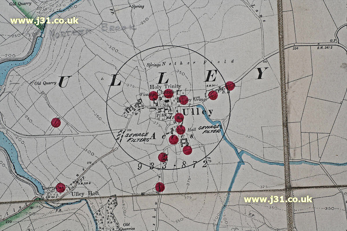
This is a map of Ulley in 1905. It’s taken from a map of the watershed of Ulley Reservoir by Rotherham council. Which is why there’s such an emphasis on brooks (in blue) and sewage filters. The red dots are ‘pollution points’ (sewers?). Ulley has grown in size in the last century, but by nothing like the same extent as nearby Aston-cum-Aughton or Thurcroft.